✨ PREMIUM FULLY FURNISHED 1BHK PG | ULWE, NAVI MUMBAI
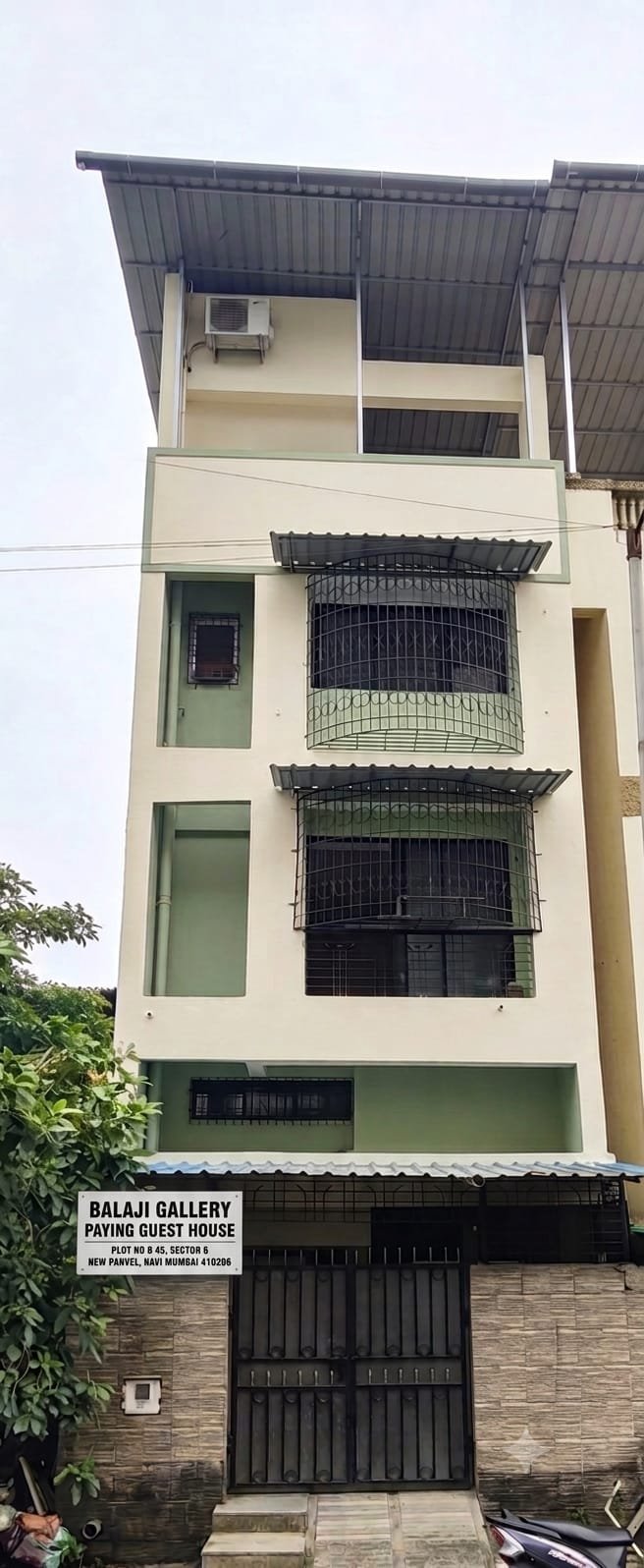
🏡 Premium Boys’ Accommodation | Ananta Tower | Sector 6 | Near Bamandongri
🏠 PROPERTY CONFIGURATION
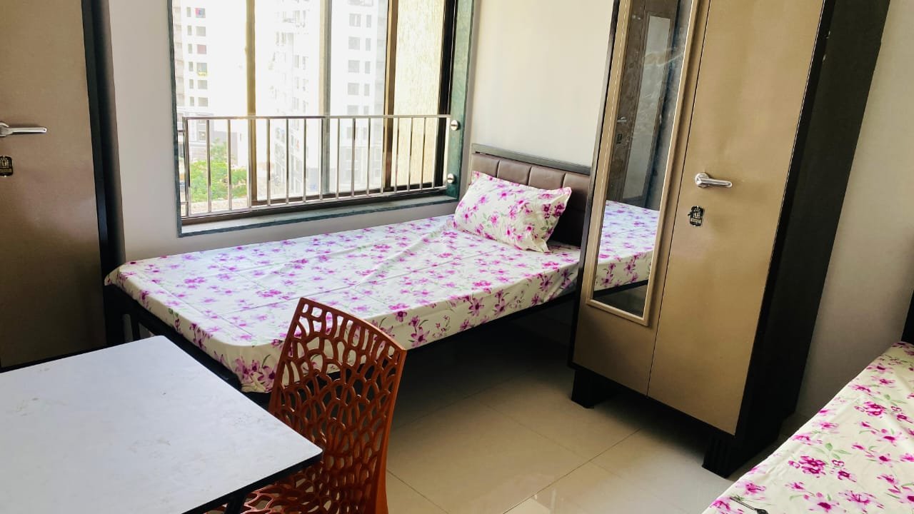
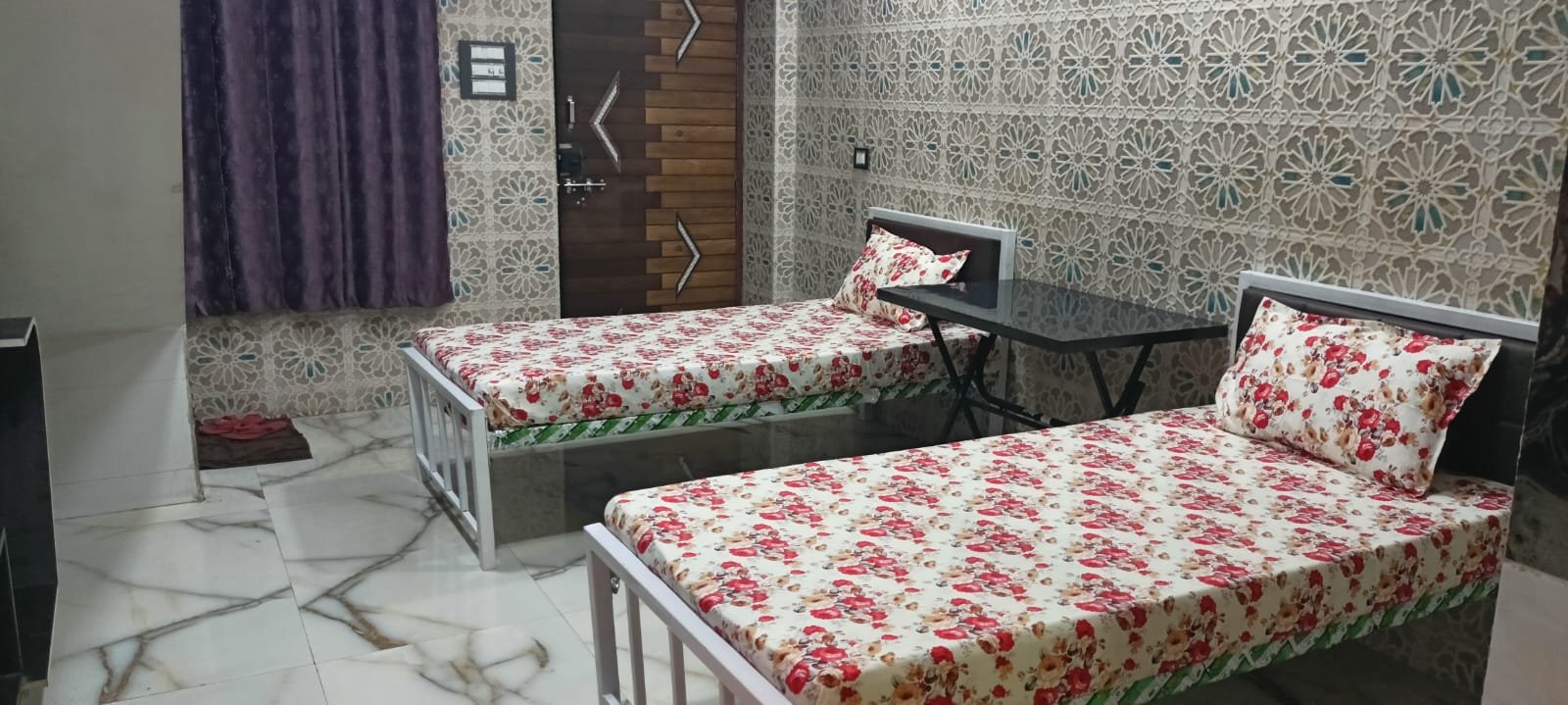
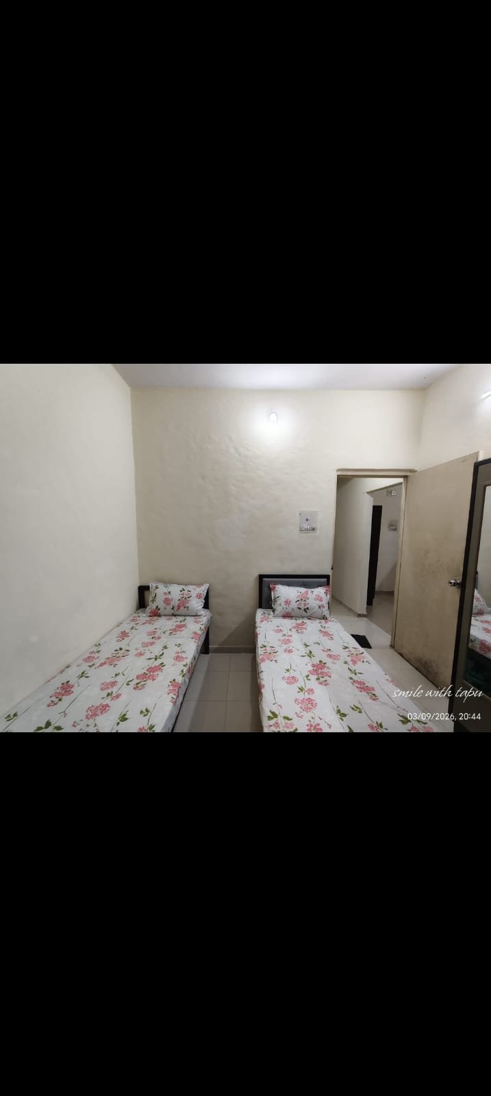
- 🏢 Property Type: Fully Furnished 1BHK Apartment
- 👨 Occupancy: 5 Residents
- 🚿 Washroom: 1 Western Common Washroom
- 📍 Location: Ananta Tower, Sector 6, Ulwe
💳 ONE-TIME CHARGES
- Joining, Documentation, Police Verification & Rent Agre...
✨ PREMIUM FULLY FURNISHED 1BHK PG | ULWE, NAVI MUMBAI
🏡 Premium Boys’ Accommodation | Ananta Tower | Sector 6 | Near Bamandongri
🏠 PROPERTY CONFIGURATION
- 🏢 Property Type: Fully Furnished 1BHK Apartment
- 👨 Occupancy: 5 Residents
- 🚿 Washroom: 1 Western Common Washroom
- 📍 Location: Ananta Tower, Sector 6, Ulwe
💳 ONE-TIME CHARGES
- Joining, Documentation, Police Verification & Rent Agreement: ₹2,500
📦 SERVICES INCLUDED
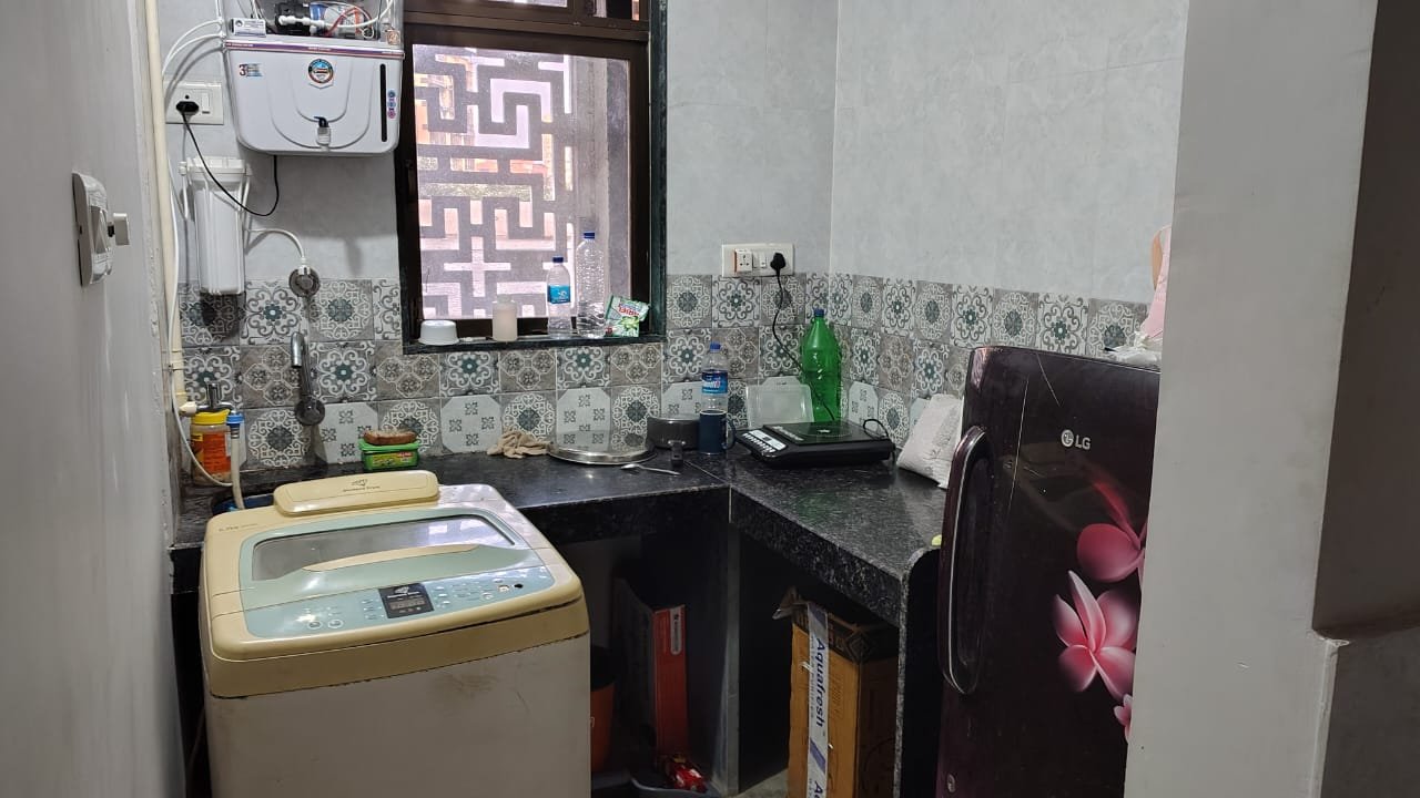
- 🔥 Gas Facility
- 📶 Wi-Fi
- 🧹 Daily & Alternate-Day Cleaning
- 🏢 Maintenance Bill Included
- 💧 Water Bill Included
- ✨ Monthly Deep Cleaning
- 🛡️ Monthly Pest Control
- ✅ No Hidden Charges
🍽️ FOOD & COOKING
- 🍳 Self-Cooking Allowed
- 🥡 Tiffin Services Available Nearby
📜 HOUSE RULES & POLICIES
- 💳 Rent Payable in Advance
- ⚡ Electricity Bill Charged Separately
- 📅 Minimum Lock-In Period: 3 Months
- 📢 Notice Period: 1 Month
- 🚫 Opposite Gender Not Allowed
- 🧾 Payment via App or Cash with OTP Receipt
🛡️ TRUST & PREMIUM HIGHLIGHTS
- ✅ Police-Verified Tenants
- 📍 Residential Location in Ulwe, Navi Mumbai
- 🏢 Professional Management
- 💰 Transparent Rent & Deposit Structure
- 🛋️ Fully Furnished Setup
- 🧹 Regular Cleaning & Monthly Deep Cleaning
- 🛡️ Monthly Pest Control
- 🚫 No Hidden Charges
📍 NEARBY LOCATIONS & CONNECTIVITY | APPROX. 5 KM RADIUS
🚉 RAILWAY STATIONS & SUBURBAN TRAIN CONNECTIVITY
- 🚉 **Bamandongri Railway Station** — Approx. 100–500 m from the Ananta Tower area | Around 2–7 mins walking; the tower is listed opposite the station.
- 🚉 **Targhar Railway Station** — Approx. 2 km | Around 5–10 mins by road; walking time depends on the route.
- 🚉 **Kharkopar Railway Station** — Approx. 2–3 km | Around 7–12 mins by road.
- 🚉 **Gavhan Railway Station** — Approx. 4 km | Around 10–15 mins by road, depending on the approach.
- 🚆 **Nerul–Uran suburban railway corridor** — Access towards Nerul, Seawoods, CBD Belapur, Targhar, Bamandongri, Kharkopar and further stations on the corridor.
- 🚆 **CBD Belapur Railway Station** — Approx. 7 km or more by route; interchange access towards the wider Navi Mumbai and Mumbai suburban network.
- 🚆 **Seawoods–Darave Railway Station** — Outside the immediate 5 km radius; connects to the wider suburban network and Seawoods shopping district.
🚇 METRO CONNECTIVITY
- 🚇 **Navi Mumbai Metro Line 1** — Does not currently serve Ulwe; the nearest practical metro access depends on the destination and onward transport route.
- 🚇 **Proposed metro extensions and future airport connectivity** — Check the latest official operational status before advertising a station or travel time.
🛣️ MAJOR ROADS, HIGHWAYS & REGIONAL CONNECTIVITY
- 🛣️ **Uran Road / Uran–Panvel Road corridor** — Major road connection serving Ulwe, Uran and Panvel; access distance depends on the road entrance.
- 🛣️ **JNPT Road** — Regional road connection towards JNPT, the port area and adjoining industrial zones; not every section is within 5 km.
- 🛣️ **Bamandongri Railway Station approach road** — Immediate access to the station and Ananta Tower area.
- 🛣️ **Sector 6 main approach roads** — Local access to the building, station, nearby shops and residential complexes.
- 🛣️ **Chhatrapati Shivaji Maharaj Marg** — Road serving the Sector 20 area and Radcliffe School; the exact distance from the property depends on the route.
- 🛣️ **Gyan Vikas Road / local Ulwe sector-road connections** — Local access towards residential sectors and educational facilities; confirm the specific road segment on the map.
- 🛣️ **Palm Beach Road corridor** — Regional connectivity towards Seawoods and other Navi Mumbai nodes; the actual access point is not necessarily within walking distance.
- 🛣️ **Mumbai Trans Harbour Link (Atal Setu) approach connectivity** — Road access towards Mumbai via the relevant Ulwe and Nhava Sheva approach roads; entry-point distance and toll-route travel time vary.
- 🛣️ **Sion–Panvel Highway** — Regional highway connection reached through connecting roads; outside the immediate property neighbourhood.
- 🛣️ **Thane–Belapur Road** — Major industrial and corporate corridor reached via connecting roads; outside the immediate 5 km neighbourhood.
🛤️ INTERNAL ROADS, SECTOR ROADS & RESIDENTIAL LANES
- 🛤️ **Sector 6 internal roads** — Immediate access from the property.
- 🛤️ **Ananta Tower approach lane** — Direct building access near Bamandongri Railway Station.
- 🛤️ **Sector 6 residential lanes** — Nearby apartment buildings, shops and everyday services.
- 🛤️ **Sector 5 internal roads** — Nearby residential and commercial access; route-dependent distance.
- 🛤️ **Sector 9 internal roads** — Local access towards residential buildings, markets and healthcare facilities.
- 🛤️ **Sector 17 internal roads** — Access to hospitals, shops and residential complexes.
- 🛤️ **Sector 18 internal roads** — Residential connectivity within the Ulwe node.
- 🛤️ **Sector 19 internal roads** — Access towards hospitals, schools and neighbourhood businesses.
- 🛤️ **Sector 20 internal roads** — Local access towards schools and residential societies.
- 🛤️ **Sector 2 internal roads** — Access towards the northern Ulwe residential area.
- 🛤️ **Sector 23 and GP Road area** — Access towards educational institutions and developing residential areas; distance depends on the exact destination.
- 🛤️ **Bamandongri station-side connecting lanes** — Short routes between the station, tower and local businesses.
- 🛤️ **CIDCO residential access roads** — Internal roads connecting housing clusters and sector amenities.
- 🛤️ **Local gali roads and society access lanes** — Small connecting lanes between apartment buildings, shops, parking areas and sector roads; individual lane names and walking distances require on-site map verification.
🏢 CORPORATE OFFICES, IT PARKS & MNC BUSINESS HUBS
- 🏢 **CIDCO Ulwe Node Office** — Near the Bamandongri area; approximately 300–700 m from the station-side locality, depending on the starting point.
- 🏢 **Reliance SEZ / nearby corporate development corridor** — Regional employment area towards Ulwe and adjoining nodes; exact campus distance should be verified before publishing.
- 🏢 **Millennium Business Park (MBP), Mahape** — Major IT and corporate employment hub outside the immediate 5 km radius.
- 🏢 **Electronic Zone, Mahape** — Corporate, technology and commercial office district outside the immediate neighbourhood.
- 🏢 **Reliance Corporate Park, Ghansoli** — Major corporate campus outside the 5 km radius.
- 🏢 **DAKC, Kopar Khairane** — Major technology and office campus outside the immediate Ulwe area.
- 🏢 **Airoli Mindspace** — Major corporate and IT employment hub requiring a longer road or rail commute.
- 🏢 **CBD Belapur commercial district** — Offices, banks and corporate services accessible via the Ulwe–Belapur road and railway connections.
- 🏢 **Seawoods commercial district** — Corporate offices and retail businesses in the wider Navi Mumbai region.
🏭 INDUSTRIES, FACTORIES & LOGISTICS
- 🏭 **Ulwe local commercial and industrial plots** — Small commercial premises, workshops and service businesses in the developing node.
- 🏭 **JNPT / Jawaharlal Nehru Port industrial corridor** — Port, logistics and freight-related employment; specific terminals are outside the immediate 5 km radius.
- 🏭 **JNPT Road industrial and warehouse belt** — Regional logistics and industrial access; exact distance varies by facility.
- 🏭 **NMSEZ / Navi Mumbai Special Economic Zone area** — Regional industrial and commercial development zone; verify operational status and exact destination before listing as a nearby employer.
- 🏭 **TTC MIDC industrial area** — Manufacturing and engineering hub outside the immediate Ulwe neighbourhood.
- 🏭 **Pawane industrial area** — Regional industrial belt requiring a longer commute.
- 🏭 **Mahape industrial and technology zone** — Industrial, office and technology facilities beyond the immediate 5 km radius.
- 🏭 **Uran and port-side logistics facilities** — Regional industrial and freight employment accessible via the Uran road network.
🛒 SHOPPING, SUPERMARKETS & DAILY ESSENTIALS
- 🛒 **Ananta Tower ground-floor shops and services** — In-building and immediate-neighbourhood convenience; individual businesses vary.
- 🛒 **Bamandongri Station market area** — Shops and quick-service businesses close to the station.
- 🛒 **Sector 6 local market** — Nearby daily essentials, groceries and convenience shopping.
- 🛒 **Sector 5 local shops** — Grocery stores, pharmacies and neighbourhood services; exact distance depends on the shop.
- 🛒 **Sector 9 market and Reliance SMART Point area** — Grocery shopping and daily essentials in the surrounding locality.
- 🛒 **Sector 17 commercial area** — Local shops, eateries, pharmacies and services.
- 🛒 **Sector 19 commercial area** — Shops and services around the hospital and residential complexes.
- 🛒 **Sector 20 shops and neighbourhood businesses** — Daily essentials and local services.
- 🛒 **Local vegetable vendors, grocery stores and bakeries** — Available across developed Ulwe sectors.
- 🛒 **Reliance SMART Point, Sector 9** — Supermarket reference point in the wider nearby locality.
- 🛍️ **Nexus Seawoods / Seawoods Grand Central Mall** — Major shopping and entertainment destination outside the immediate 5 km radius.
- 🛍️ **Inorbit Mall, Vashi** — Regional shopping destination outside the immediate Ulwe neighbourhood.
🏥 HOSPITALS, CLINICS & MEDICAL FACILITIES
- 🏥 **Oracare Advanced Dental Care Centre** — Reported nearby healthcare landmark; approx. 400 m from a Sector 6 reference property, but the exact route from Ananta Tower should be checked.
- 🏥 **Balaji Hospital, Sector 5** — Nearby multispeciality hospital; exact route and distance depend on the building entrance.
- 🏥 **Unity Hospital, Sector 9** — Near Reliance SMART Point; local multispeciality facility.
- 🏥 **Dr. Karande’s Bone & Joint Care Multispeciality Hospital, Sector 17** — Orthopaedic and multispeciality healthcare.
- 🏥 **Q Hospitals, Sector 17** — Multispeciality medical facility.
- 🏥 **Om Sai Hospital, Sector 19** — Multispeciality hospital in the Ulwe locality.
- 🏥 **The Millennium Multispecialty Hospital, Sector 19** — Healthcare and diagnostic services.
- 🏥 **Galaxy Multispecialty Hospital, Sector 19** — Local hospital in the NMS Icon complex.
- 🏥 **Reigner Hospital, Vahal Gaothan** — Multispeciality healthcare facility in the wider Ulwe locality.
- 🏥 **Ulwe Superspeciality Hospital, Sector 19** — Multispeciality medical services.
- 🏥 **Shree Siddhivinayak Hospital and Critical Care, Sector 19B** — Hospital serving the wider Ulwe locality.
- 🏥 **Local medical stores, diagnostic centres and clinics** — Available throughout the developed Ulwe sectors.
🎓 SCHOOLS, COLLEGES & EDUCATIONAL INSTITUTIONS
- 🎓 **Radcliffe School, Sector 20** — School near Bamandongri Railway Station; exact route distance depends on the property entrance.
- 🎓 **Indian Model School, Sector 19** — School and junior-college reference in the wider locality.
- 🎓 **St. Wilfred’s School, Sector 2** — School in the Ulwe node.
- 🎓 **MIT Pune’s Vishwashanti Gurukul School, Sector 23** — Educational institution outside or near the outer edge of the immediate 5 km area.
- 🎓 **Sau. Shakuntala Ramsheth Thakur School, Sector 24** — School in the wider Ulwe node; route-dependent distance.
- 🎓 **Local preschools, tuition classes and coaching centres** — Available in developed residential sectors.
- 🎓 **CBD Belapur and Seawoods educational institutions** — Additional options accessible by local train and road.
🏟️ PARKS, SPORTS COMPLEXES & RECREATION
- 🏟️ **Ramsheth Thakur International Sports Complex** — Major sports facility in Ulwe; distance and travel time depend on the approach road.
- 🌳 **CIDCO Pond** — Local open-space landmark in the wider Bamandongri locality.
- 🌳 **Sector-level parks and playgrounds** — Small neighbourhood recreation spaces distributed across Ulwe's residential sectors.
- 🌊 **Panvel Creek waterfront areas** — Regional natural landscape; access depends on the permitted approach and specific location.
🚌 BUS STOPS, AUTOS & PUBLIC TRANSPORT
- 🚌 **Bamandongri Railway Station bus/auto access** — Immediate transport hub beside the property locality.
- 🚌 **Ulwe local bus stops** — Available along sector roads; individual stop names and distances should be verified on the map.
- 🚌 **NMMT bus connectivity** — Services connect Ulwe with surrounding Navi Mumbai nodes, subject to route and timetable.
- 🚕 **Auto-rickshaws** — Generally available near the station and on main sector roads.
- 🚖 **App-based cab access** — Pickup availability depends on the time and exact location.
- 🚆 **Railway connectivity** — Bamandongri provides access to the Nerul–Uran corridor, with onward connections via the wider suburban network.
🌆 NEARBY LOCALITIES & RESIDENTIAL AREAS
- 📍 **Sector 6, Ulwe** — Immediate property location.
- 📍 **Bamandongri locality** — Immediate neighbourhood surrounding the railway station.
- 📍 **Sector 5, Ulwe** — Nearby residential and commercial sector.
- 📍 **Sector 9, Ulwe** — Residential and market area.
- 📍 **Sector 17, Ulwe** — Residential, medical and commercial area.
- 📍 **Sector 18, Ulwe** — Nearby residential locality.
- 📍 **Sector 19, Ulwe** — Residential area with hospitals and schools.
- 📍 **Sector 20, Ulwe** — Residential locality and school zone.
- 📍 **Sector 2, Ulwe** — Residential area towards the northern side of the node.
- 📍 **Sector 23, Ulwe** — Developing residential and educational area.
- 📍 **Vahal / Wahal Gaothan** — Locality adjoining the Ulwe area.
- 📍 **Kharkopar** — Nearby railway-served locality.
- 📍 **Targhar** — Nearby railway-served locality and airport-side area.
- 📍 **Gavhan** — Wider locality on the Nerul–Uran corridor.
- 📍 **CBD Belapur** — Major commercial and transport hub outside the immediate 5 km radius.
- 📍 **Seawoods and Nerul** — Wider Navi Mumbai localities accessible through the suburban railway network.
- 📍 **Panvel and Uran** — Regional destinations connected through the road network.
🗺️ KEY LANDMARKS & LOCAL REFERENCE POINTS
- 📍 **Ananta Tower, Plot No. 2, Sector 6** — Main building landmark.
- 📍 **Bamandongri Railway Station** — Immediate major transport landmark.
- 📍 **CIDCO Ulwe Node Office** — Nearby civic reference point.
- 📍 **Ulwe Fire Station** — Local emergency-service landmark in the Bamandongri area.
- 📍 **Radcliffe School** — Educational landmark in Sector 20.
- 📍 **Reliance SMART Point, Sector 9** — Shopping reference landmark.
- 📍 **Ramsheth Thakur International Sports Complex** — Sports and recreation landmark.
- 📍 **NMS Icon, Sector 19** — Commercial building containing local healthcare facilities.
- 📍 **Uran Road corridor** — Regional road landmark.
- 📍 **JNPT Road corridor** — Regional industrial and logistics connection.
- 📍 **Navi Mumbai International Airport area** — Major regional infrastructure landmark; road access and operational status should be checked for the intended terminal.
🚦 CONNECTIVITY SUMMARY
- 🚉 Railway: Bamandongri Station is the nearest major transport landmark; Targhar and Kharkopar are additional nearby stations.
- 🛣️ Roads: Ulwe sector roads, Uran Road and connecting roads towards JNPT and the wider Navi Mumbai network.
- 🏢 Employment: Ulwe commercial areas, port-related employment and wider corporate hubs across Belapur, Mahape, Ghansoli and Airoli.
- 🏭 Industry: Regional JNPT logistics, port facilities and wider industrial corridors.
- 🛒 Essentials: Local sector markets, shops and Reliance SMART Point.
- 🏥 Healthcare: Hospitals and clinics across Sectors 5, 9, 17 and 19.
- 🎓 Education: Nearby schools and institutions across Ulwe's residential sectors.
- 🚌 Public Transport: Local buses, auto-rickshaws and suburban railway access.
- 🚇 Metro: No operational metro station confirmed in the immediate Ulwe neighbourhood.
- ⏱️ **Distance and travel-time note:** All distances and times should be treated as approximate until checked from the exact building pin. Walking time, driving time and straight-line distance are different. Locations beyond 5 km are identified as regional connections rather than immediate nearby amenities.
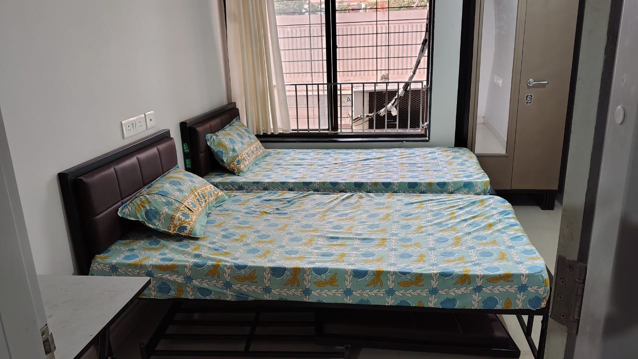
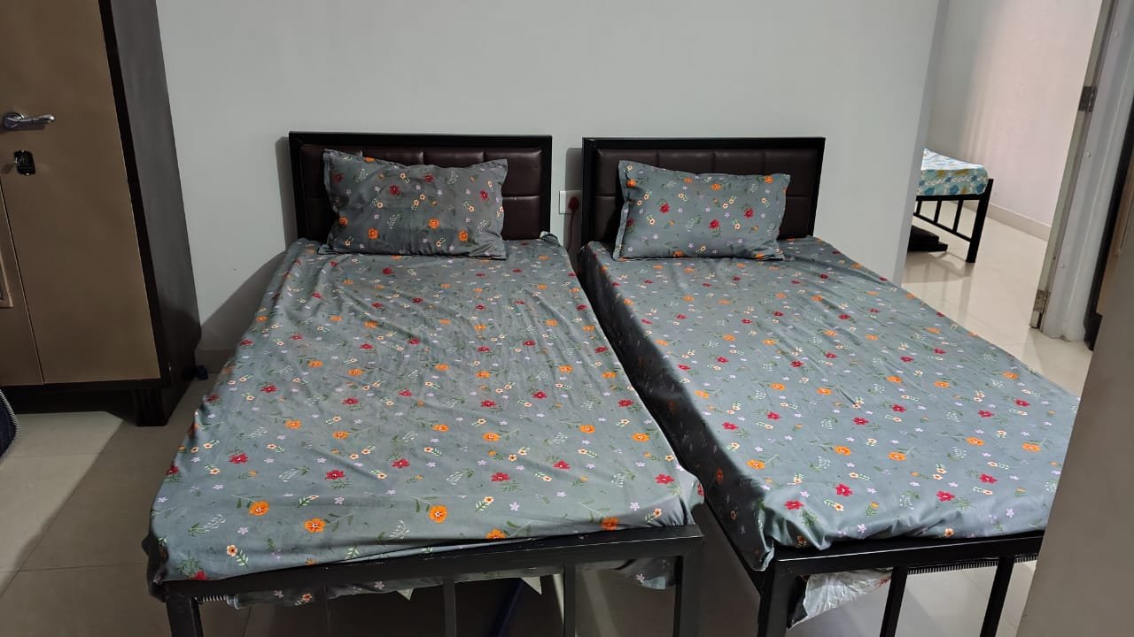
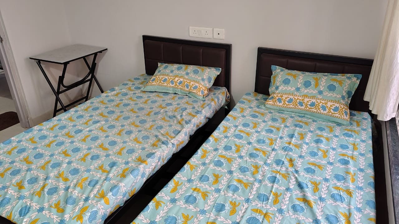
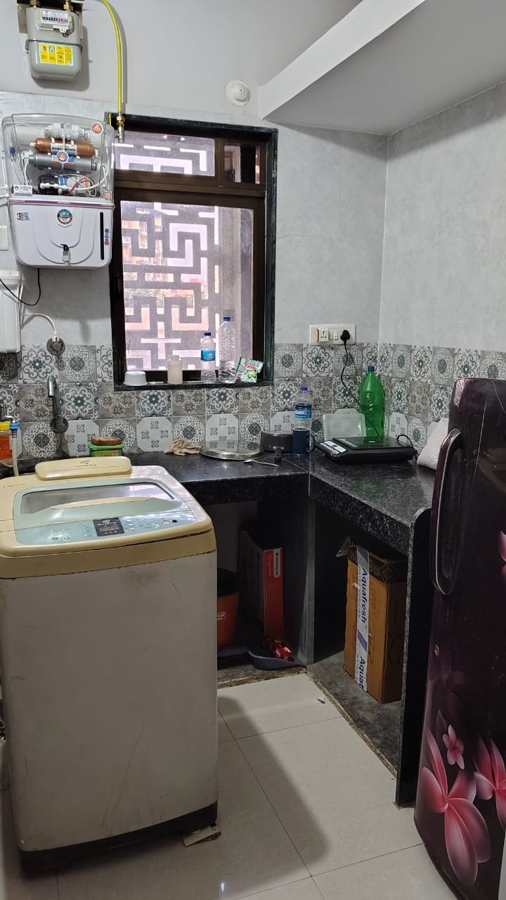


 2 Room
 4 Bed
 2 Bath
 Sft
 Wifi
 Kitchen
 Geyser
 24/7 Security
 Fan
 Washing Machine
 Air Conditioning
 Seperate Bed
 Curtain In Every Room
 Mattress
 Seperate Wardrobe
 Bedsheet
 Pillow & Pillow Cover
.png) Fridge
 Microwave Oven
 Gas/Utensils
 Cleaning Daily&Alternate Days
 Personal Keys
 Bike & Car Parking
 Mixer Grinder
 Charging Point Near Bed
 Side Table
 Table & Chair


.svg)