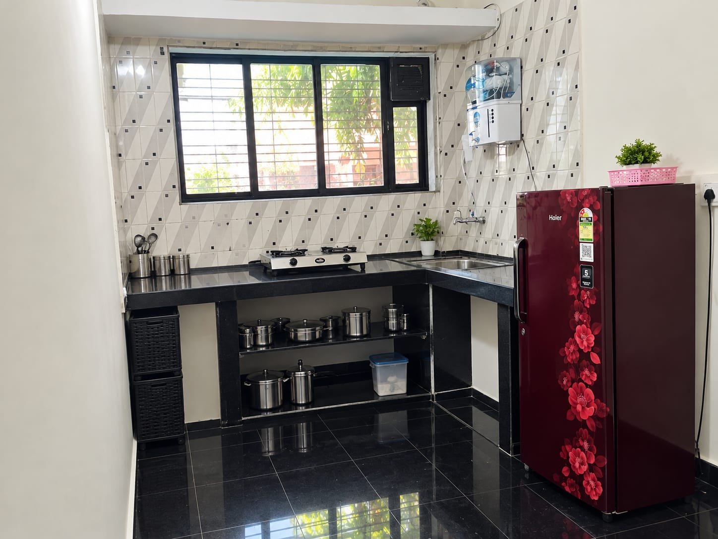
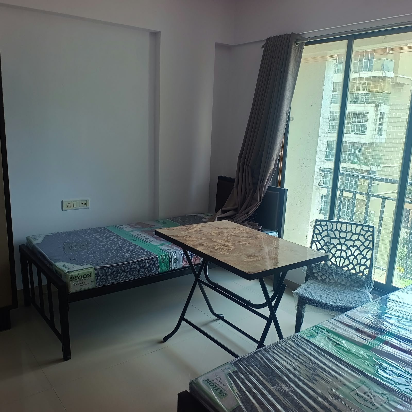
✨ PREMIUM FULLY FURNISHED 2BHK APARTMENT PG | NAUPADA, THANE WEST
🏡 Premium Accommodation | Boys Only | Swanandan Society | Prime Central Location
🏠 PROPERTY CONFIGURATION
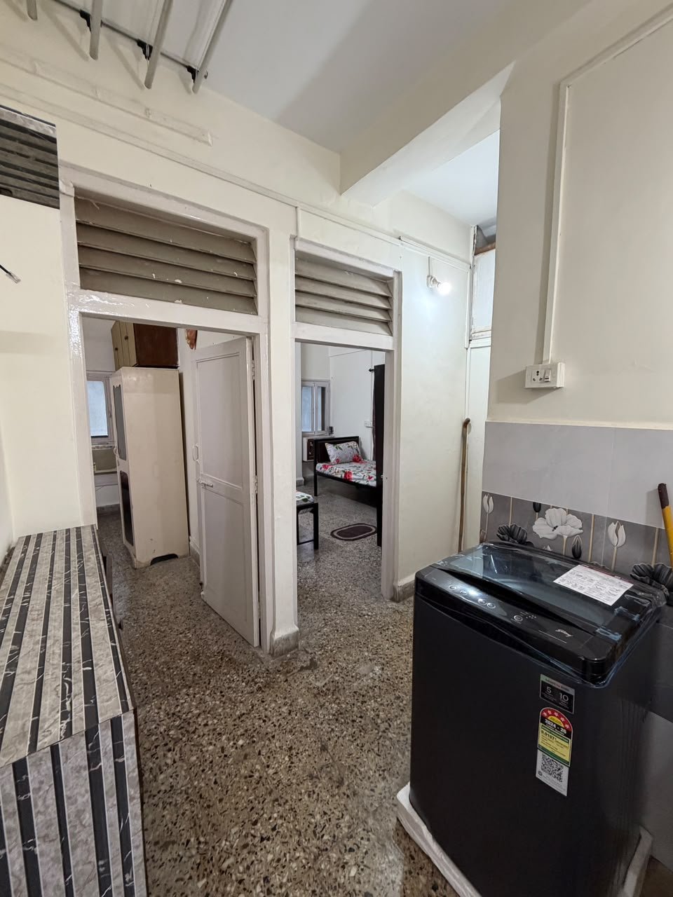
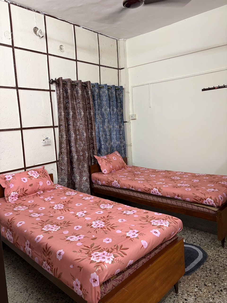
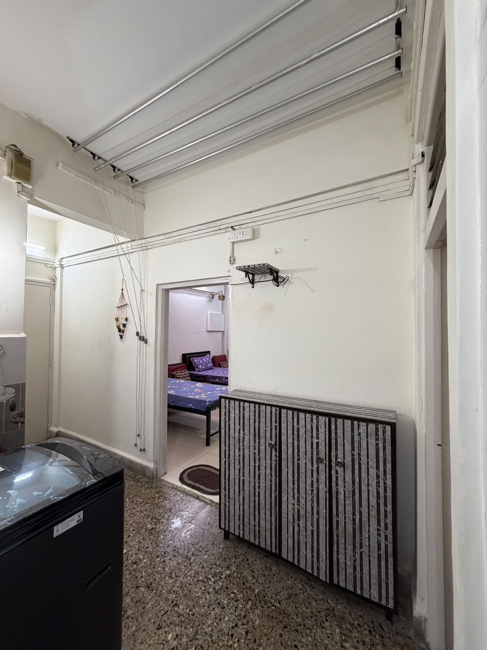
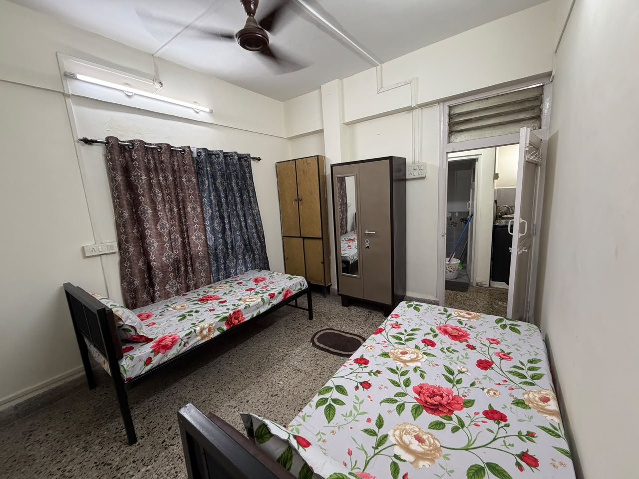
- 🏢 Property Type: Fully Furnished 2BHK Apartment
- 👥 Total Occupancy: 7 Residents
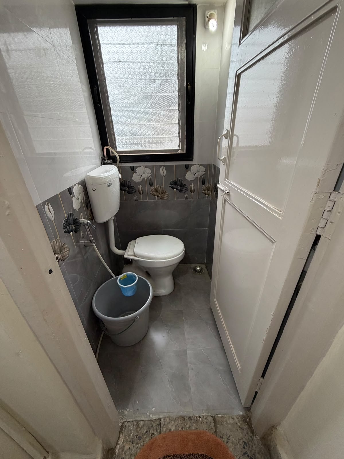
- 🚿 Washrooms: 2 Western Washrooms | Both Common
- 📍 Locality: Shivaji Nagar, Gokhale Road, Naupada, Thane West
💳 ONE-TIME CHARGES
- Jo...
✨ PREMIUM FULLY FURNISHED 2BHK APARTMENT PG | NAUPADA, THANE WEST
🏡 Premium Accommodation | Boys Only | Swanandan Society | Prime Central Location
🏠 PROPERTY CONFIGURATION
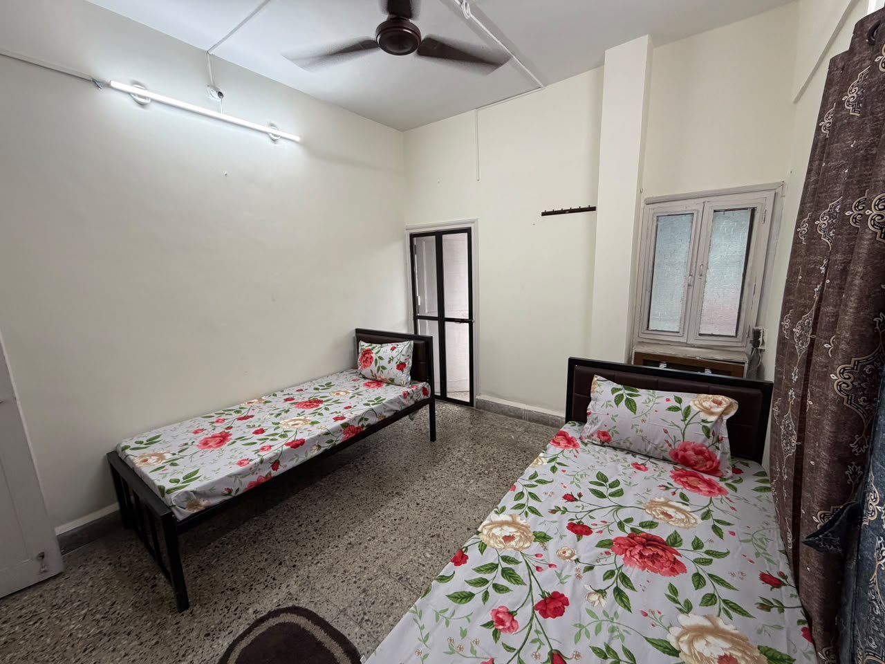
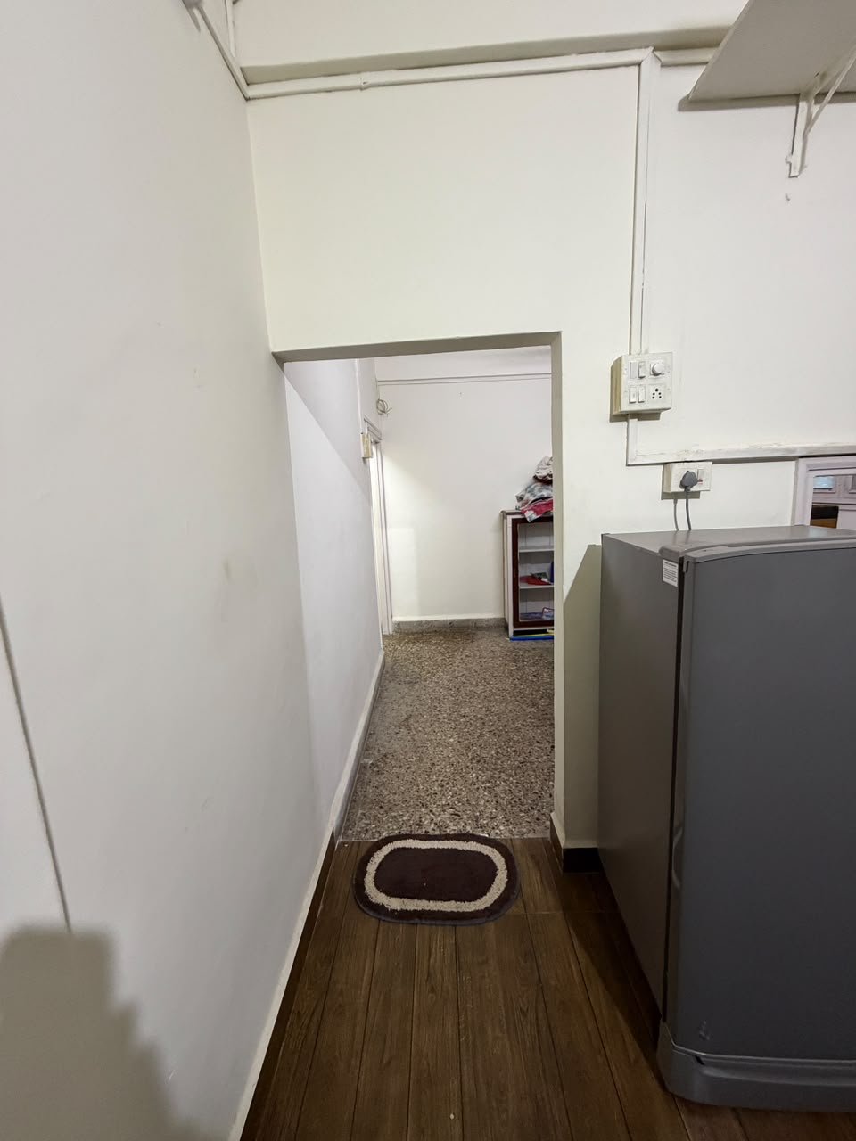
- 🏢 Property Type: Fully Furnished 2BHK Apartment
- 👥 Total Occupancy: 7 Residents
- 🚿 Washrooms: 2 Western Washrooms | Both Common
- 📍 Locality: Shivaji Nagar, Gokhale Road, Naupada, Thane West
💳 ONE-TIME CHARGES
- Joining, Documentation, Police Verification & Rent Agreement: ₹2,500
📦 SERVICES INCLUDED
- 🔥 Gas Facility
- 📶 Wi-Fi
- 🧹 Daily & Alternate-Day Cleaning
- 🏢 Maintenance Bill Included
- 💧 Water Bill Included
- ✨ Monthly Deep Cleaning
- 🛡️ Monthly Pest Control
- ✅ No Hidden Charges
🍽️ FOOD & COOKING
- 🍳 Self-Cooking Allowed
- 🥡 Tiffin Services Available Nearby
📜 HOUSE RULES & POLICIES
- 💳 Rent Payable in Advance
- ⚡ Electricity Bill Charged Separately
- ❄️ AC Electricity Charges Shared on Meter Basis
- 📅 Minimum Lock-In Period: 3 Months
- 📢 Notice Period: 1 Month
- 🚫 Opposite Gender Not Allowed
- 🧾 Payment via App or Cash with OTP Receipt
🛡️ TRUST & PREMIUM HIGHLIGHTS
- ✅ Police-Verified Tenants
- 📍 Prime Naupada Central Location
- 🚉 Convenient Railway Station Access
- 🏢 Professional Property Management
- 💰 Transparent Rent & Deposit Structure
- 🛋️ Fully Furnished Accommodation
- 🧹 Regular Cleaning & Monthly Deep Cleaning
- 🛡️ Monthly Pest Control
- 🚫 No Hidden Charges📍 NEARBY LOCATIONS & CONNECTIVITY | APPROX. 5 KM RADIUS
🚉 RAILWAY STATIONS & SUBURBAN TRAIN CONNECTIVITY
- 🚉 **Thane Railway Station – West Entrance** — Approx. 1–1.5 km | 5–15 mins by road; walking time varies by the exact building entrance.
- 🚉 **Thane Railway Station – Main Junction** — Major Central Railway and Trans-Harbour connectivity towards Mumbai, Kalyan, Dombivli, Navi Mumbai and adjoining destinations.
- 🚉 **Kalwa Railway Station** — Approx. 3–4 km | Around 10–15 mins by road, depending on traffic and route.
- 🚉 **Mulund Railway Station** — Approx. 5–6 km | Around 15–25 mins by road; at or beyond the outer edge of the requested radius.
- 🚆 **Central Line** — Access through Thane Station for travel towards Dadar, CSMT, Ghatkopar, Kalyan and other Central Railway destinations.
- 🚆 **Trans-Harbour Line** — Access from Thane Station towards Airoli, Rabale, Ghansoli, Kopar Khairane, Vashi and onward connections.
- 🚆 **Mumbai suburban interchange connectivity** — Connections towards Harbour Line destinations are available through the relevant interchange stations.
🚇 METRO CONNECTIVITY
- 🚇 **Marathon Chowk / Cadbury Junction Metro Line 4 corridor** — Upcoming Mumbai Metro Line 4 connectivity; exact station location and operational status must be verified before advertising a travel time.
- 🚇 **Cadbury Junction** — Approx. 2–3 km | Around 8–15 mins by road, depending on the route.
- 🚇 **Majiwada Metro corridor** — Approx. 4–5 km | Around 12–20 mins by road; station access and operating status should be confirmed.
- 🚇 **Metro Line 4 (Wadala–Kasarvadavali)** — Planned to improve connectivity between Thane, Ghatkopar-side interchange areas and eastern Mumbai; do not treat proposed stations as operational until officially confirmed.
🛣️ MAJOR ROADS, HIGHWAYS & ARTERIAL CONNECTIVITY
- 🛣️ **Lal Bahadur Shastri Marg (LBS Road)** — Approx. 200–500 m from the wider Naupada locality | Around 2–7 mins by road, depending on the access point.
- 🛣️ **Eastern Express Highway (EEH)** — Approx. 1.5–2.5 km | Around 5–12 mins by road.
- 🛣️ **Teen Hath Naka Junction** — Approx. 1.5–2 km | Around 5–10 mins by road.
- 🛣️ **Ghodbunder Road** — Approx. 5–6 km to the nearest relevant access points | Around 15–25 mins by road; portions may fall outside the 5 km radius.
- 🛣️ **Gokhale Road / Gopal Krishna Gokhale Marg** — Immediate locality road serving shops, residences and station-side commercial areas.
- 🛣️ **Ram Maruti Road** — Nearby central Thane road connecting residential and commercial areas; distance depends on the exact junction.
- 🛣️ **Naupada Main Road network** — Immediate local access to housing societies, markets and daily services.
- 🛣️ **Mahatma Gandhi Road (M.G. Road)** — Nearby commercial and medical corridor in Naupada.
- 🛣️ **Station Road, Thane West** — Access to the railway station, bus interchange, markets and commercial establishments.
- 🛣️ **Jambli Naka approach roads** — Local access towards the station-west side, municipal offices and old Thane commercial areas.
- 🛣️ **Mumbai–Nashik Highway / NH 160 corridor** — Regional highway connectivity reached through the connecting arterial-road network.
- 🛣️ **Thane–Belapur Road** — Regional access towards Airoli, Rabale, Ghansoli and Navi Mumbai; outside the immediate walking neighbourhood.
- 🛣️ **Mumbai–Agra Road corridor** — Regional road connection towards the wider Thane and Nashik direction.
🛤️ INTERNAL ROADS, SOCIETY LANES & LOCAL GALI ROADS
- 🛤️ **Gokhale Road residential stretch** — Immediate access from Swanandan Society.
- 🛤️ **Shivaji Nagar internal roads** — Residential lanes and connecting roads in the property locality.
- 🛤️ **Naupada internal roads** — Access to local markets, homes, clinics and commercial premises.
- 🛤️ **Ram Maruti Road connecting lanes** — Nearby residential and commercial access.
- 🛤️ **Mahatma Gandhi Road connecting lanes** — Access to medical facilities, shops and local businesses.
- 🛤️ **Station-side approach lanes** — Connect the residential locality with Thane Station West and surrounding commercial areas.
- 🛤️ **Panchpakhadi internal roads** — Access towards residential societies, offices and local amenities.
- 🛤️ **Teen Hath Naka approach roads** — Connect local roads with LBS Marg and the Eastern Express Highway.
- 🛤️ **Talao Pali approach roads** — Access to the lakefront, temples and central Thane.
- 🛤️ **Local society access lanes** — Short connecting lanes between apartment entrances, parking areas and the main roads.
- 🛤️ **Neighbourhood gali roads** — Smaller residential passages around Naupada and Shivaji Nagar; individual lane names and distances require verification from the exact map pin.
🏢 CORPORATE OFFICES, IT PARKS & MNC BUSINESS HUBS
- 🏢 **Wagle Industrial Estate** — Approx. 3–5 km | Around 10–20 mins by road; one of Thane's major employment and industrial districts.
- 🏢 **Ashar IT Park** — Wagle Estate business district; approx. 3–5 km depending on the building | Around 10–20 mins by road.
- 🏢 **Lodha iThink Techno Campus** — Thane commercial corridor; approx. 4–6 km depending on the campus and entrance.
- 🏢 **Orion Business Park** — Thane West commercial area; route-dependent distance and travel time.
- 🏢 **Opal Square IT Park** — Wagle Estate commercial hub; approximately 4–5 km or more depending on the destination entrance.
- 🏢 **Sunrise Corporate Park** — Wagle Estate office district; approx. 4–5 km or more depending on the route.
- 🏢 **Dev Corpora** — Commercial office and business destination in the wider Thane area.
- 🏢 **TCS Olympus Centre** — Corporate office campus in the wider Thane region; exact distance depends on the destination entrance.
- 🏢 **Lodha iThink Techno Campus, Kanjurmarg** — Regional corporate destination outside the immediate 5 km radius.
- 🏢 **Mindspace Airoli** — Major IT and MNC employment hub outside the immediate 5 km radius.
- 🏢 **Reliable Tech Park, Airoli** — Regional corporate employment destination.
- 🏢 **Millennium Business Park, Mahape** — Major IT and corporate campus accessible via road and railway connections.
- 🏢 **Reliance Corporate Park, Ghansoli** — Major corporate campus outside the immediate locality.
- 🏢 **Nearby banks, professional offices, service companies and commercial buildings** — Concentrated along Gokhale Road, LBS Marg, Naupada and the Wagle Estate corridor.
🏭 INDUSTRIES, FACTORIES & MANUFACTURING ZONES
- 🏭 **Wagle Industrial Estate** — Approx. 3–5 km | Around 10–20 mins by road; includes industrial premises, offices, engineering units and service businesses.
- 🏭 **Raymond industrial/commercial area** — Wider Thane industrial belt; exact distance depends on the specific facility.
- 🏭 **Mukund industrial area** — Industrial and manufacturing employment in the wider Thane region.
- 🏭 **CEAT industrial facilities** — Wider regional employment destination; verify the specific site and route.
- 🏭 **Wagle Estate MIDC and manufacturing units** — Industrial workshops, engineering companies, warehouses and commercial operations.
- 🏭 **Thane–Belapur industrial corridor** — Regional manufacturing and technology employment area outside the immediate neighbourhood.
- 🏭 **Rabale, Pawane and Mahape industrial belts** — Regional industrial destinations requiring a longer commute.
- 🏭 **Airoli industrial and commercial zone** — Regional employment area accessible via railway and road connections.
🛍️ MALLS, MARKETS & DAILY ESSENTIALS
- 🛍️ **Naupada Market** — Immediate locality; approximately 2–5 mins walking depending on the shop.
- 🛒 **Thane Market, Gokhale Road** — Nearby station-side shopping and street-market area; exact distance depends on the building entrance.
- 🛒 **Ram Maruti Road shopping stretch** — Nearby retail stores, food outlets and daily services.
- 🛒 **M.G. Road commercial area** — Shops, pharmacies, food outlets and local businesses.
- 🛒 **Station Road market area** — Railway station-side shopping, groceries and convenience stores.
- 🛒 **Panchpakhadi local markets** — Nearby residential shopping and daily-needs businesses.
- 🛍️ **Eternity Mall** — Approx. 2–3 km | Around 7–15 mins by road.
- 🛍️ **Korum Mall** — Approx. 3 km | Around 8–15 mins by road.
- 🛍️ **Viviana Mall** — Approx. 4–5 km | Around 10–20 mins by road.
- 🛍️ **R Mall, Thane** — Wider Thane shopping destination; exact distance depends on the entrance and route.
- 🛒 **Local supermarkets, bakeries, vegetable vendors and grocery stores** — Available across Naupada, Shivaji Nagar and Panchpakhadi.
- 🛒 **Pharmacies, banks, ATMs and convenience stores** — Available throughout the immediate Naupada commercial area.
🏥 HOSPITALS, CLINICS & MEDICAL FACILITIES
- 🏥 **Horizon Hospital** — Thane West; approximately 1.5–3 km depending on the route.
- 🏥 **Dr. Godbole's Heart Care Hospital** — M.G. Road, Naupada; nearby specialist and multispeciality care.
- 🏥 **Deodhar Hospital** — Gokhale Road, Naupada; local hospital and nursing-care facility.
- 🏥 **Kaushalya Medical Foundation Trust Hospital** — Thane West; distance depends on the route and entrance.
- 🏥 **Jupiter Hospital** — Eastern Express Highway area; approximately 3–5 km depending on the route.
- 🏥 **Bethany Hospital** — Thane West; approximately 3–5 km depending on the route.
- 🏥 **Civil Hospital, Thane** — Government healthcare facility in the wider central Thane area.
- 🏥 **Sapphire Hospital** — Thane region; verify the exact branch and route.
- 🏥 **Upasani Super Speciality Hospital** — Thane West healthcare destination; route-dependent distance.
- 🏥 **Platinum Hospital** — Thane region; confirm the exact facility before publishing a distance.
- 💊 **Local clinics, diagnostic centres and pharmacies** — Available along Gokhale Road, M.G. Road, Ram Maruti Road and nearby residential streets.
🎓 COLLEGES, SCHOOLS & EDUCATIONAL INSTITUTIONS
- 🎓 **Bedekar College / VPM's Bedekar College** — Thane West; approximately 1–2 km depending on the route.
- 🎓 **VPM Polytechnic** — Thane West educational campus; route-dependent distance.
- 🎓 **K.C. College of Engineering and Management Studies** — Thane region; verify the exact campus and route.
- 🎓 **Satish Pradhan Dnyanasadhana College** — Thane West; wider local educational destination.
- 🎓 **Saraswati Education Society / Saraswati School** — Naupada locality; nearby educational landmark.
- 🎓 **S.E.S. High School and Junior College** — Central Thane area; route-dependent distance.
- 🎓 **New English School & Junior College** — Thane locality; verify the exact campus.
- 🎓 **Indo Scottish Global School** — Thane region; verify the specific campus and route.
- 🎓 **St. John's High School** — Central Thane area.
- 🎓 **Vidya Prasarak Mandal educational institutions** — Thane West educational corridor.
- 🎓 **Local tuition classes, coaching centres and training institutes** — Available across Naupada and surrounding sectors.
🚌 BUS STOPS, AUTOS & PUBLIC TRANSPORT
- 🚌 **Thane Railway Station West bus interchange** — Major local bus hub; accessible from the station-side roads.
- 🚌 **Thane Station bus depot / TMT bus services** — Connectivity across Thane and nearby residential and commercial nodes.
- 🚌 **Naupada local bus stops** — Access along major neighbourhood roads; exact stop distance varies by route.
- 🚌 **Teen Hath Naka bus stops** — Access to the major junction and highway connections.
- 🚌 **Panchpakhadi bus stops** — Local connectivity towards central Thane and surrounding residential areas.
- 🚕 **Auto-rickshaws** — Commonly available along Gokhale Road, Ram Maruti Road and station approaches.
- 🚖 **App-based cab services** — Pickup availability depends on the exact location and traffic.
- 🚆 **Central Railway connectivity** — Access through Thane Station towards Mumbai and Kalyan-side destinations.
- 🚆 **Trans-Harbour connectivity** — Access towards Navi Mumbai through Thane's suburban railway connections.
🌆 NEARBY LOCALITIES & RESIDENTIAL AREAS
- 📍 **Naupada** — Immediate property locality.
- 📍 **Shivaji Nagar, Thane West** — Immediate residential neighbourhood.
- 📍 **Panchpakhadi** — Approx. 500 m–1.5 km | Around 3–10 mins by road.
- 📍 **Charai** — Nearby residential and commercial locality; route-dependent distance.
- 📍 **Talao Pali area** — Approx. 1 km or more depending on the access point.
- 📍 **Jambli Naka** — Nearby central Thane commercial and transport area.
- 📍 **Teen Hath Naka** — Approx. 1.5–2 km | Around 5–10 mins by road.
- 📍 **Louis Wadi** — Approx. 3–4 km | Around 10–20 mins by road.
- 📍 **Wagle Estate** — Approx. 3–5 km | Around 10–20 mins by road.
- 📍 **Majiwada** — Approx. 4–5 km or more depending on the destination.
- 📍 **Kalwa** — Approx. 3–4 km | Around 10–20 mins by road.
- 📍 **Mulund Check Naka** — Approx. 4–6 km depending on the route.
- 📍 **Mulund West** — Wider neighbouring Mumbai suburb, accessible by road and rail.
- 📍 **Kopri / Thane East** — Locality on the eastern side of the railway corridor.
- 📍 **Uthalsar** — Nearby Thane locality; exact distance depends on the destination.
- 📍 **Vartak Nagar** — Wider Thane residential area.
- 📍 **Manpada, Thane** — Regional residential and commercial locality, generally beyond the immediate 5 km radius.
🗺️ LANDMARKS & LOCAL REFERENCE POINTS
- 📍 **Swanandan Society, Gokhale Road** — Main property landmark.
- 📍 **Thane Railway Station West** — Major transport landmark.
- 📍 **Thane Station Foot Overbridge (FOB)** — Station access landmark.
- 📍 **Naupada Market** — Local shopping landmark.
- 📍 **Talao Pali Lake** — Central Thane lakefront and recreation landmark; route-dependent distance.
- 📍 **Teen Hath Naka Junction** — Major road junction connecting central Thane and the highway network.
- 📍 **Nitin Company Junction** — Important road junction in the wider Thane area.
- 📍 **Eternity Mall** — Shopping and entertainment landmark.
- 📍 **Korum Mall** — Major retail and entertainment destination.
- 📍 **Viviana Mall** — Large shopping and entertainment destination.
- 📍 **LBS Marg** — Key commercial and transport road.
- 📍 **Eastern Express Highway** — Main regional highway connection.
- 📍 **Wagle Industrial Estate** — Major employment and industrial landmark.
- 📍 **Ashar IT Park** — Office and technology employment destination.
- 📍 **Dr. Godbole's Heart Care Hospital** — Nearby healthcare landmark.
- 📍 **Deodhar Hospital** — Local healthcare landmark on Gokhale Road.
- 📍 **Thane Municipal Corporation area** — Civic and public-service destination in central Thane.
- 📍 **Dadoji Konddev Stadium** — Sports landmark in the wider central Thane area.
- 📍 **Ghantali Devi Temple** — Religious landmark in the Naupada area.
- 📍 **Kaupineshwar Temple** — Historic temple in central Thane.
🚦 CONNECTIVITY SUMMARY
- 🚉 Railway: Thane Station provides Central and Trans-Harbour Line connections.
- 🚇 Metro: Upcoming Metro Line 4 corridor; confirm official operating status before advertising station access.
- 🛣️ Roads: Gokhale Road, Ram Maruti Road, M.G. Road, LBS Marg and Eastern Express Highway.
- 🏢 Employment: Wagle Estate, Ashar IT Park, Lodha iThink and other Thane commercial districts.
- 🏭 Industry: Wagle Estate and the wider Thane–Belapur industrial corridor.
- 🛍️ Shopping: Naupada Market, Eternity Mall, Korum Mall and Viviana Mall.
- 🏥 Healthcare: Horizon Hospital, Jupiter Hospital, Bethany Hospital and nearby Naupada clinics.
- 🎓 Education: Bedekar College, VPM institutions, Dnyanasadhana College and local schools.
- 🚌 Public Transport: TMT buses, autos, cabs and railway services.
- ⏱️ **Distance note:** All distances and travel times are approximate. Walking, road and straight-line distances differ; verify the exact route from Swanandan Society before publication.
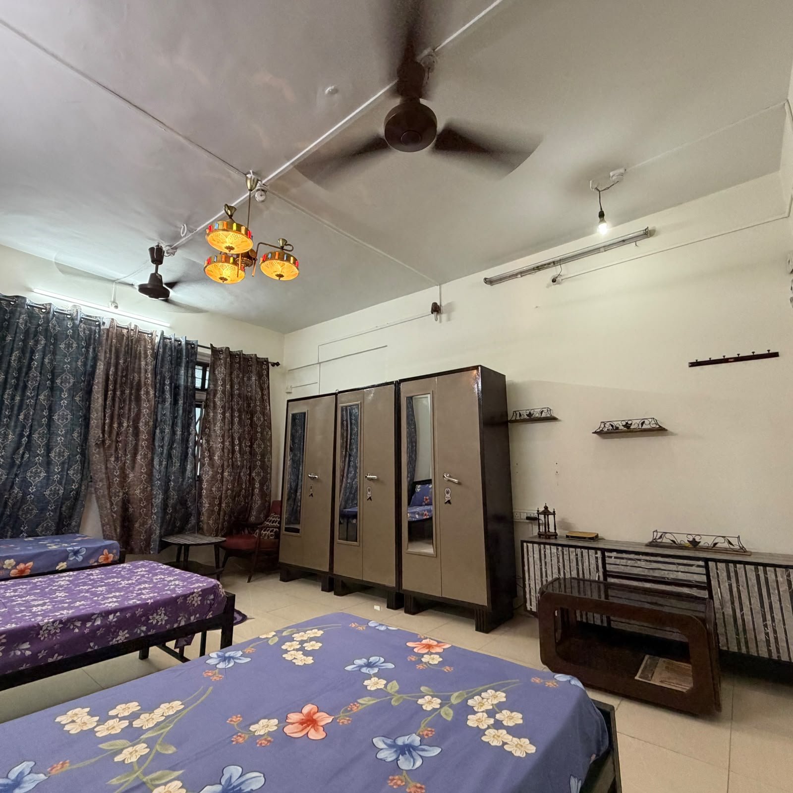
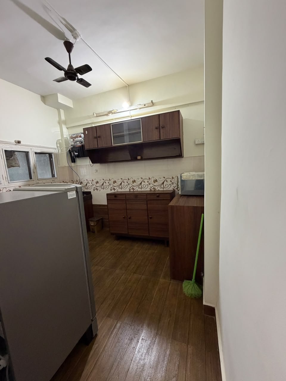


 3 Room
 7 Bed
 2 Bath
 Sft
 Wifi
 Kitchen
 Geyser
 24/7 Security
 Fan
 Washing Machine
 Air Conditioning
 Seperate Bed
 Curtain In Every Room
 Mattress
 Seperate Wardrobe
 Bedsheet
 Pillow & Pillow Cover
.png) Fridge
 Microwave Oven
 Gas/Utensils
 Cleaning Daily&Alternate Days
 Personal Keys
 Bike & Car Parking
 Mixer Grinder
 Charging Point Near Bed
 Side Table
 Table & Chair


.svg)